Survey Systems Used in the USA: GNSS, CORS, State Plane Coordinates, GIS and Infrastructure Surveying
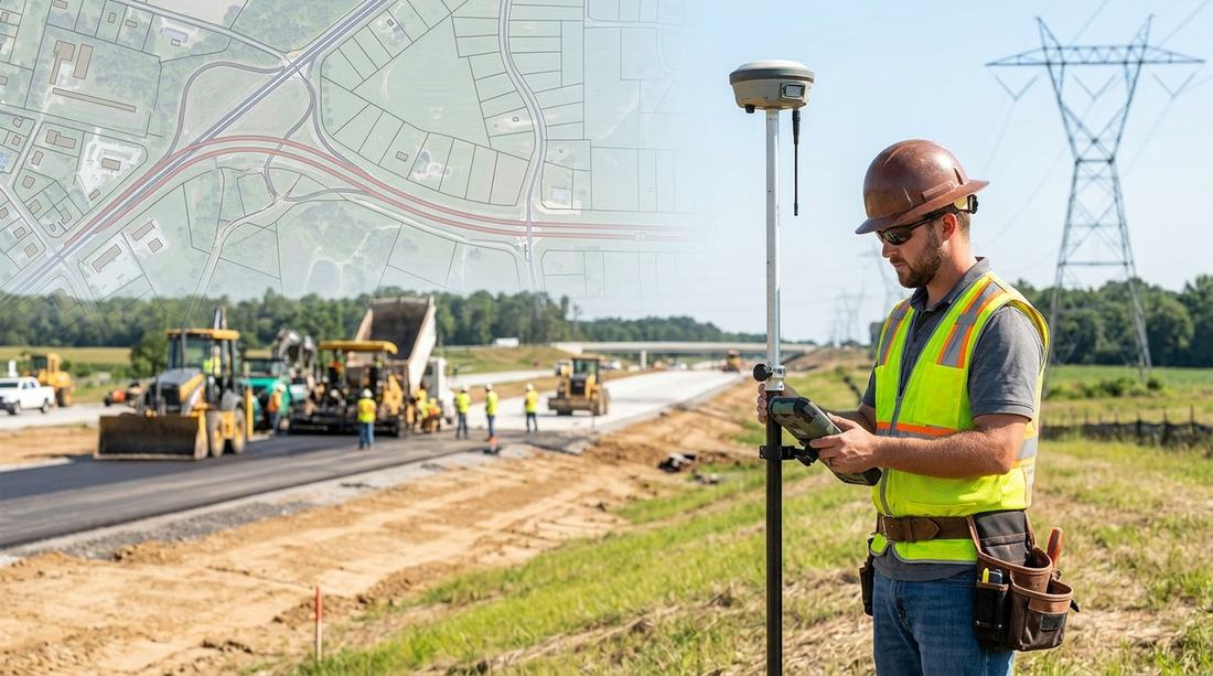
Surveying in the United States is a highly developed field that combines GNSS, CORS networks, total stations, digital levels, GIS, LiDAR, aerial mapping and national and state coordinate systems. Unlike countries where surveying may follow one centralized municipal system, the U.S. surveying environment involves federal, state, county, municipal and private-sector organizations.
At the national level, the National Geodetic Survey (NGS), part of NOAA, provides and maintains the National Spatial Reference System (NSRS). The NSRS provides a consistent framework for latitude, longitude, height, scale, gravity and orientation across the United States.
For surveyors and GIS professionals, understanding the U.S. surveying system is important because a project can involve several coordinate systems, local control networks, state standards, engineering requirements and GIS databases.
This article explains the major survey systems used in the USA, the technologies used by professional surveyors, common field problems, and the growing role of GIS in transportation, utilities and infrastructure management.
Quick Overview of Survey Systems Used in the USA
The major surveying and positioning systems used in the United States include:
- National Spatial Reference System (NSRS)
- NOAA National Geodetic Survey (NGS)
- NOAA Continuously Operating Reference Stations (CORS)
- GNSS and RTK surveying
- Network RTK / Real-Time Networks
- State Plane Coordinate System (SPCS)
- UTM coordinate system
- Local and project-specific coordinate systems
- Total station surveying
- Digital and differential leveling
- Cadastral and boundary surveying
- Topographic surveying
- Construction surveying
- ALTA/NSPS Land Title Surveys
- Aerial surveying and photogrammetry
- LiDAR and mobile mapping
- GIS-based infrastructure and asset management
The appropriate system depends on the project's location, accuracy requirements, state regulations, client specifications and the required deliverable.
1. Does the USA Have One Surveying System?
No. This is one of the most important things to understand about surveying in the United States.
The U.S. has a national geodetic framework, but surveying is also influenced by state laws, local requirements, project specifications and professional licensing regulations.
At the federal level, NOAA's National Geodetic Survey defines and maintains the NSRS. At the state level, departments of transportation and other agencies may maintain their own survey standards, control networks and GIS databases. At the local level, counties, cities and municipalities can have additional requirements.
Private survey companies then work within these frameworks to perform boundary surveys, topographic surveys, construction surveys, ALTA/NSPS surveys, subdivision surveys, utility surveys, right-of-way surveys, engineering surveys and geodetic surveys.
Therefore, a surveyor working in Texas may encounter different requirements from one working in California, Florida, New York or Washington.
2. National Spatial Reference System (NSRS)
The National Spatial Reference System, or NSRS, is the foundation of high-accuracy positioning in the United States.
NOAA's National Geodetic Survey defines the NSRS as a consistent coordinate system covering the United States and its territories. It includes information about latitude, longitude, height, scale, gravity, orientation, geodetic control, shoreline information, and Continuously Operating Reference Stations.
The NSRS allows surveyors, engineers and mapping professionals to establish positions that are compatible with other surveys and datasets. This is particularly important for infrastructure — if two engineering teams work on different sections of the same highway, their survey information needs to fit together spatially. A common reference framework helps make this possible.
3. NOAA National Geodetic Survey (NGS)
The National Geodetic Survey (NGS) is part of NOAA's National Ocean Service.
NGS provides the geodetic framework supporting civilian positioning and mapping in the United States. Its work includes geodetic control, reference frames, CORS, GNSS data processing, coordinate transformations, State Plane Coordinates, elevation information, geoid models, survey marks, and aerial and remote-sensing applications.
NGS also provides tools such as OPUS — Online Positioning User Service, which allows users to submit survey-grade GNSS observations and obtain positions referenced to the NSRS.
4. CORS: Continuously Operating Reference Stations
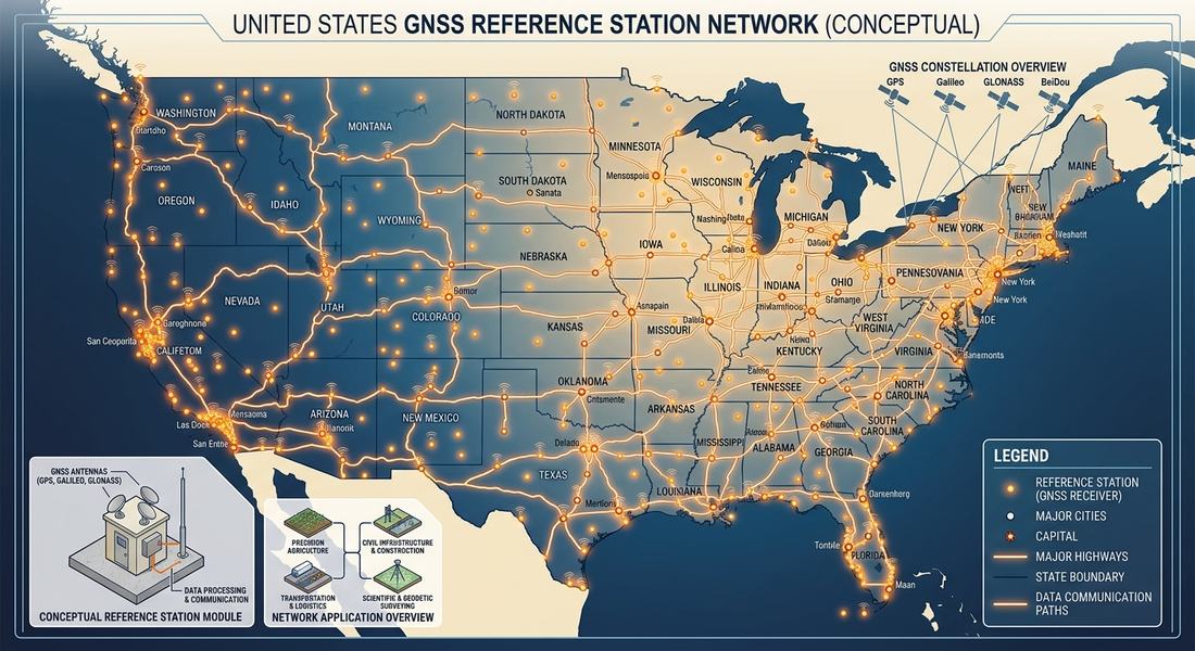
One of the most important survey systems in the USA is the NOAA Continuously Operating Reference Station (CORS) Network.
CORS stations are permanently installed GNSS reference stations that continuously collect satellite positioning data. The NOAA CORS Network is a cooperative network involving government, academic and private organizations.
According to NOAA, surveyors, engineers and GIS professionals can use CORS data to improve GNSS positioning and align their work with the National Spatial Reference System. Post-processed positioning can achieve accuracies approaching a few centimeters in suitable circumstances.
This makes CORS particularly useful for geodetic surveying, engineering surveys, construction, GIS data collection, infrastructure mapping, monitoring, research and high-accuracy positioning.
5. GNSS and RTK Surveying in the USA
Modern American surveyors commonly use GNSS receivers for high-precision positioning. GNSS includes satellite navigation systems such as GPS, GLONASS, Galileo and BeiDou.
A professional survey-grade GNSS receiver can be used with CORS corrections, RTK base stations, Network RTK, Real-Time Networks and post-processing.
What Is RTK?
RTK — Real-Time Kinematic surveying — uses correction information to improve GNSS positioning in real time. A typical workflow might involve:
GNSS rover → correction service → reference station/network → corrected coordinates
RTK is widely used for boundary surveys, topographic surveys, construction layout, road surveys, utility mapping, control surveys and GIS data collection.
However, RTK is not a replacement for professional surveying judgment. Surveyors must still evaluate satellite geometry, multipath, signal obstructions, control quality, coordinate reference system, equipment calibration, field procedures and quality-control checks.
6. State Plane Coordinate System in the USA
One of the most important concepts for anyone working with U.S. survey data is the State Plane Coordinate System (SPCS).
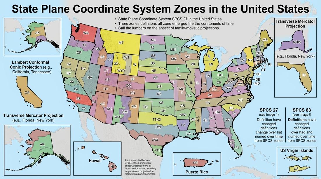
The State Plane Coordinate System was developed to provide coordinate systems suitable for large-scale surveying, engineering and mapping. Instead of using latitude and longitude directly, State Plane coordinates provide projected Easting and Northing coordinates.
NOAA explains that State Plane systems were created to support surveying, engineering and mapping throughout the United States and its territories. Different states contain different State Plane zones — this creates one of the major challenges for GIS and surveying professionals working across state boundaries.
7. SPCS83 and the New SPCS2022
The U.S. is currently going through an important transition in its geodetic reference system.
The older State Plane Coordinate System of 1983, commonly called SPCS83, is being superseded by the State Plane Coordinate System of 2022 (SPCS2022) as part of the modernization of the NSRS.
NGS describes SPCS2022 as the third generation of the State Plane Coordinate System. The new system is designed around the modernized 2022 terrestrial reference frames.
This transition is particularly important for surveyors, GIS analysts, civil engineers, transportation agencies, mapping companies, utility companies and engineering consultants. Organizations managing long-term spatial databases will need to carefully manage the relationship between legacy and modernized coordinate systems.
8. UTM vs State Plane Coordinates
Both UTM and State Plane coordinates can be encountered in American GIS and surveying projects.
UTM — the Universal Transverse Mercator system divides the world into longitudinal zones. It is commonly used for GIS, mapping, remote sensing, environmental projects and regional datasets.
State Plane — designed specifically for large-scale mapping and surveying within states and their zones. Often preferred where minimizing distortion is important for engineering and cadastral applications.
The choice depends on project location, accuracy requirements, state standards, client requirements, existing GIS database and engineering specifications.
9. Total Station Surveying
GNSS has become extremely important, but the total station remains one of the most important tools used by professional surveyors in the USA.
Total stations are particularly useful when satellite positioning is unreliable or unavailable — in dense urban environments, inside structures, under bridges, in areas with heavy vegetation, on construction sites, or inside buildings.
A total station can measure angles, distances, elevations and positions. Modern robotic total stations can also be operated remotely and integrated with digital field controllers.
10. Digital Leveling and Elevation Surveying
Horizontal coordinates are only part of a survey. Infrastructure projects also require accurate vertical information.
Surveyors may use digital or precise leveling to establish benchmarks, road elevations, bridge elevations, building elevations, drainage levels and construction elevations.
Elevation work can become particularly challenging because the U.S. has historically used different vertical datums and local benchmarks — another area affected by the ongoing modernization of the NSRS.
11. OPUS: NOAA's Online Positioning User Service
OPUS is an important tool for U.S. GNSS surveyors. NOAA describes OPUS as a service that provides access to high-accuracy NSRS coordinates.
A surveyor can upload a GNSS observation file collected with suitable survey-grade equipment and receive a computed position referenced to the NSRS. OPUS can be useful for checking control, establishing survey positions, processing static GNSS observations, connecting projects to national reference information, and supporting geodetic surveys.
12. Common Types of Surveys in the USA
American survey companies perform many different types of surveys:
- Boundary Surveys — used to establish or retrace property boundaries
- Topographic Surveys — used to map terrain and physical features
- ALTA/NSPS Land Title Surveys — used extensively in commercial real-estate transactions and land development
- Construction Surveys — used to establish design points and verify construction
- Right-of-Way Surveys — important for roads, highways, utilities and transportation projects
- Utility Surveys — used to map underground and above-ground utility infrastructure
- As-Built Surveys — used to document what was actually constructed
- Geodetic Surveys — used for high-accuracy positioning and control
- Hydrographic Surveys — used to map underwater environments
- Aerial Surveys — use aircraft, UAVs or other platforms to collect large quantities of spatial information
13. Major Problems Surveyors Face in the USA
Modern surveying equipment has become extremely sophisticated, but field surveying still presents significant challenges.
13.1 Multipath and GNSS Signal Problems
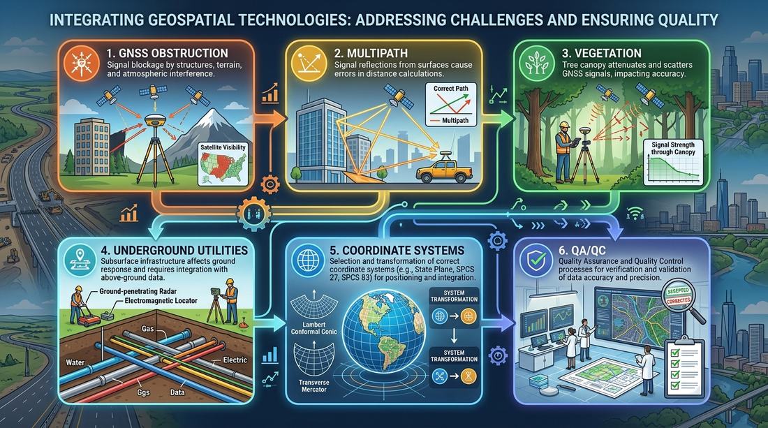
Buildings, bridges, metal structures and other surfaces can reflect GNSS signals, producing inaccurate measurements. Urban environments can be particularly challenging because satellite visibility may be blocked by high-rise buildings.
14. Vegetation and Difficult Terrain
Heavy vegetation can interfere with GNSS observations and make conventional surveying more difficult. Surveyors may need to combine GNSS, total station, leveling, LiDAR and aerial imagery to obtain complete information.
15. Underground Utilities
One of the biggest infrastructure challenges is determining the location of underground utilities — water, sewer, gas, electricity, telecommunications, fiber-optic networks and stormwater.
The problem is not simply collecting coordinates. Surveyors and GIS professionals also need to determine what the feature is, exactly where it is, its elevation, whether the location is surveyed or inferred, its source, and how accurate the information is. This is why utility GIS requires strong data-quality procedures.
16. Different Coordinate Systems
A major challenge for GIS and surveying professionals is that different projects may use different coordinate systems — geographic coordinates, State Plane, UTM, local engineering coordinates, county GIS coordinates, or project-specific grids.
If the coordinate reference system is misunderstood, data can appear shifted or incorrectly aligned. This is one reason professional GIS teams need strong knowledge of datums, projections, coordinate transformations, units, vertical reference systems and epochs.
17. Changing Geodetic Datums
The United States is currently undergoing a major modernization of its national geodetic reference framework. NGS is developing new reference frames and a new geopotential datum as part of the modernized NSRS.
The future framework includes NATRF2022, PATRF2022, CATRF2022, MATRF2022, NAPGD2022 and SPCS2022. NGS's current modernization schedule includes new tools and products being developed and released through 2026, with the modernized system continuing toward formal adoption.
This creates an important challenge for professionals managing legacy datasets — a GIS analyst may have to work with data created using older datums while new survey information uses newer reference frames.
18. Data Quality and Survey-to-GIS Problems
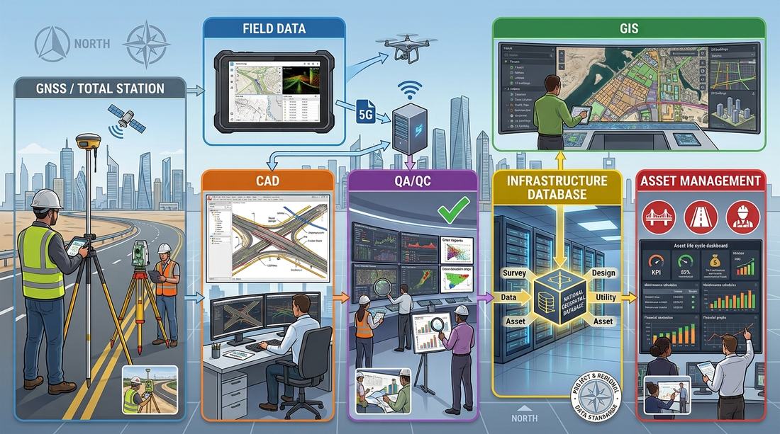
Another common problem occurs when survey data is transferred between systems. A typical workflow might be:
Field Survey → Survey Controller → CAD → GIS → Enterprise Database
At every stage, errors can occur — incorrect coordinate system, wrong units, missing attributes, incorrect feature codes, duplicate features, poor topology, wrong elevation values, geometry errors, incomplete metadata. This is why QA/QC is one of the most important parts of modern surveying and GIS.
19. GIS and Infrastructure in the USA
GIS has become a major technology for managing American infrastructure. Government agencies and transportation organizations use GIS to manage spatial information about highways, bridges, roads, railways, airports, public transit, utilities, drainage, water infrastructure, sewer systems and emergency infrastructure.
The Federal Highway Administration has documented the growing use of GIS in transportation asset management. GIS allows transportation agencies to visualize infrastructure assets, analyze their condition, plan maintenance activities, evaluate alternatives and support investment decisions.
20. GIS for Transportation Asset Management
Transportation is one of the largest applications of GIS in the U.S. A GIS database can contain information about road centerlines, pavement, bridges, culverts, guardrails, signs, signals, lighting, drainage, shoulders, intersections, traffic counts, crash locations and construction projects.
FHWA reports that State DOTs use GIS for asset and performance management, data collection and decision support. GIS can also combine infrastructure information with other datasets — for example, Road Condition + Traffic Volume + Crash Data + Population + Project Cost can be analyzed spatially to support transportation planning.
21. GIS for Utility Infrastructure
GIS is also extremely important for utilities. Utility companies and public agencies can use GIS to manage:
Water — water mains, valves, hydrants, service connections, pump stations, storage facilities
Sewer — sewer mains, manholes, pump stations, outfalls, treatment facilities
Electricity — poles, transformers, substations, transmission lines, distribution networks
Telecommunications — fiber-optic cables, conduits, cabinets, towers, network infrastructure
Gas — pipelines, valves, regulators, service connections
The spatial relationship between these assets is essential for maintenance, planning and emergency response.
22. GIS for Water Resources and Flood Management
GIS also plays a major role in water-resource management. The U.S. Geological Survey provides GIS-based applications for hydrologic modeling, water-resource planning, engineering and environmental management.
For example, USGS's StreamStats provides GIS analytical tools that can delineate drainage areas and provide basin characteristics and flow statistics for water-resource applications. GIS can therefore help analyze watersheds, rivers, drainage basins, flood-prone areas, stormwater, wetlands, groundwater and water infrastructure.
23. GIS for Emergency Management
During disasters, accurate spatial information can be critical. GIS can combine roads, buildings, population, hospitals, fire stations, police stations, flood zones, wildfire boundaries, evacuation routes and utility infrastructure — allowing emergency managers to understand where an event is occurring and which assets or communities may be affected.
24. GIS for Urban Planning
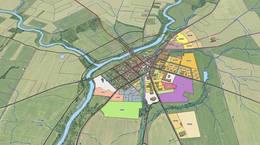
Cities and counties use GIS for land-use planning, zoning, building development, transportation planning, parcel management, environmental analysis, infrastructure planning and population analysis. Survey data provides the accurate physical information needed to keep these systems reliable.
25. GIS for Environmental Management
GIS is widely used for wetland mapping, forest management, wildlife habitat, coastal monitoring, soil mapping, flood analysis, pollution monitoring and natural-resource management. Remote sensing and LiDAR can provide additional information that can be integrated into GIS.
26. LiDAR and Remote Sensing in U.S. Surveying
LiDAR has become an important technology for large-area mapping. It can provide detailed three-dimensional information about terrain, buildings, roads, vegetation, power infrastructure and coastal areas.
NOAA's National Geodetic Survey identifies remote sensing, aerial photography and LiDAR as important technologies for collecting spatial information over large areas. LiDAR is particularly valuable where conventional field surveying would be slow or difficult.
27. Mobile Mapping and 3D Surveying
Another growing area is mobile mapping. A mobile mapping system can combine GNSS, LiDAR, cameras, inertial measurement units and vehicle-based positioning to capture large amounts of road and infrastructure data — useful for highway surveys, pavement inventories, road furniture, sign inventories, utility corridors and asset management.
28. Surveying and GIS: Where the Two Meet
A surveyor may collect highly accurate coordinates for a road asset. The GIS team can then store that information with attributes such as asset ID, type, condition, installation date, ownership, inspection date and maintenance history.
This changes the value of survey information. Instead of simply knowing where an asset is, the organization can understand what it is, what condition it's in, who owns it, when it was inspected, and whether it requires maintenance. That is the foundation of modern GIS-based asset management.
29. The Biggest Challenges for GIS and Survey Professionals
The most important challenges are not always related to equipment — they often involve data and organizational issues. Common challenges include:
- Different coordinate systems
- Legacy survey data
- Changing datums
- Poor metadata
- Incomplete utility records
- Underground utility uncertainty
- GNSS obstruction and multipath
- Data interoperability
- CAD-to-GIS conversion
- Different agency standards
- Large volumes of LiDAR and imagery
- Maintaining accurate asset inventories
- Field-to-office data synchronization
- Staff training
- QA/QC requirements
FHWA research on GIS-based transportation asset management has also identified organizational and technical challenges, including fragmented organizational structures, training needs and the difficulty of integrating GIS with engineering and asset-management functions.
30. The Future of Surveying and GIS in the USA
The U.S. surveying industry is moving toward increasingly digital workflows. Future developments include:
- Modernized geodetic reference systems — the modernization of the NSRS will change how surveyors and GIS professionals work with coordinates and reference frames
- Real-time GNSS — Network RTK and CORS-based positioning will continue to support high-accuracy field data collection
- 3D GIS — infrastructure databases will increasingly incorporate three-dimensional information
- Digital twins — cities and infrastructure owners can combine survey data, GIS, BIM and sensor information to create digital representations of physical assets
- AI-assisted mapping — artificial intelligence can help identify features from imagery, LiDAR and point clouds
- Automated QA/QC — GIS and surveying software can increasingly identify geometry errors, missing attributes, duplicate features, coordinate problems and topological inconsistencies
- Integrated asset management — survey data will increasingly become part of long-term infrastructure management rather than being treated as a one-time project deliverable
31. Surveying in the USA vs Surveying in the UAE
For professionals who work internationally, there are interesting differences between the U.S. and UAE approaches.
| Area | USA | UAE |
|---|---|---|
| National geodetic framework | NOAA/NGS NSRS | Emirate-specific authority frameworks |
| GNSS | Widely used | Widely used |
| CORS | NOAA CORS + other RTNs | Reference networks/VRS |
| State/local systems | Strong state/local variation | Strong emirate/authority variation |
| State Plane | Major U.S. projected system | Not equivalent to U.S. SPCS |
| GIS | Extensive federal/state/local use | Extensive government/municipal use |
| Infrastructure GIS | Transportation, utilities, public assets | Roads, utilities, land, buildings and infrastructure |
| LiDAR | Widely used | Increasingly used |
| Digital mapping | Highly developed | Highly developed |
| Geodetic modernization | Major NSRS modernization underway | Authority-specific standards and modernization |
The key similarity is that both countries are moving toward integrated surveying, GIS, infrastructure databases and digital spatial systems. The major difference is the institutional structure and the specific coordinate-reference frameworks used.
Frequently Asked Questions About Surveying in the USA
- What surveying system is used in the USA?
- The United States uses several interconnected systems, including the National Spatial Reference System, CORS, GNSS/RTK, State Plane Coordinate System, UTM, total stations and leveling.
- What is the National Spatial Reference System?
- The NSRS is the national geodetic framework maintained by NOAA's National Geodetic Survey. It provides consistent information about latitude, longitude, height, scale, gravity and orientation across the United States.
- What is CORS in surveying?
- CORS means Continuously Operating Reference Station. CORS stations continuously collect GNSS observations and provide reference information that can be used to improve positioning accuracy.
- What is the NOAA CORS Network?
- The NOAA CORS Network is a cooperative network of GNSS reference stations used by surveyors, engineers, GIS professionals and scientists to support high-accuracy positioning.
- What is the State Plane Coordinate System?
- The State Plane Coordinate System is a set of projected coordinate systems designed for surveying, engineering and mapping within the United States and its territories.
- Is State Plane better than UTM?
- Neither system is universally "better." The appropriate system depends on the project, accuracy requirements, agency standards and existing datasets.
- What is SPCS2022?
- SPCS2022 is the new generation of the State Plane Coordinate System being developed as part of the modernized NSRS. It is designed around the new 2022 terrestrial reference frames.
- What is OPUS in surveying?
- OPUS, or Online Positioning User Service, is an NGS service that processes survey-grade GNSS observations and provides positions referenced to the NSRS.
- What are the biggest surveying challenges in the USA?
- Common challenges include GNSS obstruction and multipath, difficult terrain, vegetation, underground utilities, different coordinate systems, legacy datasets, datum transformations, state-specific requirements and maintaining accurate GIS databases.
- How is GIS used in U.S. infrastructure?
- GIS is used extensively for transportation asset management, roads, bridges, utilities, water resources, emergency management, planning and infrastructure maintenance. FHWA has documented GIS applications for transportation asset inventory, condition management, planning and decision support.
- Why is GIS important for surveyors?
- GIS allows survey measurements to become part of larger spatial databases. Instead of simply storing coordinates, organizations can connect location information with asset attributes, condition, ownership, inspection and maintenance information.
Conclusion
The survey systems used in the USA are based on a combination of national geodetic infrastructure, state and local requirements, modern positioning technology and increasingly sophisticated GIS systems.
At the foundation is NOAA's National Spatial Reference System, supported by the National Geodetic Survey, CORS networks, survey marks, coordinate systems and geodetic models. Professional surveyors then combine these systems with:
GNSS + RTK + CORS + Total Station + Leveling + State Plane Coordinates + GIS + LiDAR + Remote Sensing
The biggest challenge is no longer simply collecting coordinates. Modern professionals must also understand coordinate reference systems, datums, data quality, GIS databases, infrastructure assets, QA/QC and interoperability.
At the same time, GIS has become a critical part of U.S. infrastructure management. Transportation agencies use GIS to manage roads, bridges and other assets, while GIS is also used for utilities, water resources, emergency management, urban planning and environmental applications.
The next major transformation is already underway with the modernization of the U.S. National Spatial Reference System and the introduction of new reference frames, NAPGD2022 and SPCS2022.
For surveyors and GIS professionals, the future is therefore not just about measuring the physical world. It is about creating accurate, connected and continuously usable digital information about land, infrastructure and the built environment.
Khurram Shahzad
← Back to all articles