The Current Surveying System in the UAE: From GNSS and CORS to Digital GIS
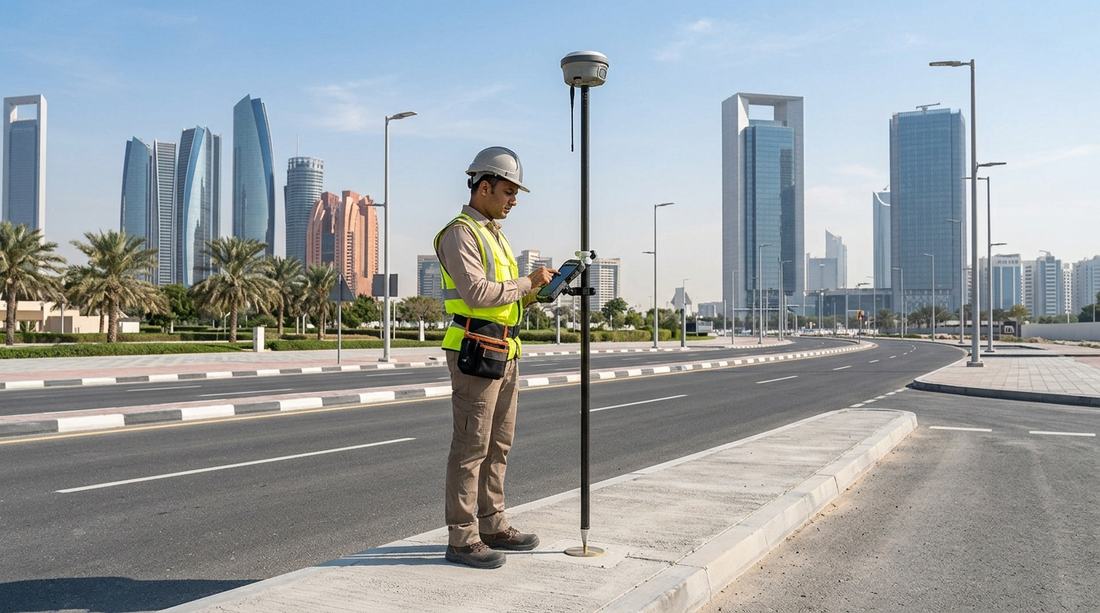
The United Arab Emirates has developed one of the region's most technology-driven surveying and geospatial environments. Rapid urban development, large infrastructure projects, new communities, transportation networks and utilities have created a strong need for accurate, standardized and digitally managed spatial data.
Today, surveying in the UAE is no longer limited to traditional total stations, paper plans and field measurements. Modern surveying increasingly combines GNSS, continuously operating reference stations, digital cadastral systems, GIS, CAD, remote sensing, LiDAR, aerial imagery and online government platforms.
While each emirate has its own authorities, standards and procedures, the overall direction is similar: accurate field data, controlled coordinate systems, digital submissions, centralized spatial databases and increasingly automated quality control.
1. What Is the UAE Surveying System?
The UAE does not operate under one single surveying platform for every emirate. Surveying and geospatial activities are regulated and managed by the relevant government authorities in each emirate.
For example:
- Abu Dhabi — Department of Municipalities and Transport (DMT) and its municipalities
- Dubai — Dubai Municipality, with coordination with other relevant government entities
- Other emirates — their respective municipalities and government authorities
These authorities establish surveying standards, coordinate systems, control networks, professional requirements and procedures for submitting and approving survey information.
In Dubai, for example, Law No. 6 of 2017 specifically regulates survey works and defines activities including geodetic, topographic, cadastral and hydrographic surveying. The law also establishes Dubai Municipality's role in maintaining survey control networks and the land-survey database.
This means that a professional surveyor working in the UAE must understand not only surveying technology, but also the specific standards and digital submission requirements of the emirate in which the project is located.
2. From Traditional Surveying to Digital Surveying
Traditional surveying relied heavily on instruments such as:
- Total stations
- Levels
- Theodolites
- Manual field books
- Physical control monuments
- Paper survey drawings
These instruments remain important, particularly for engineering and construction work. However, the UAE has progressively integrated satellite positioning and digital systems into the surveying workflow.
Modern survey projects may combine:
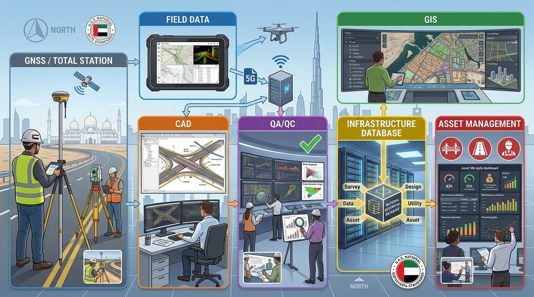
GNSS + CORS/VRS + Total Station + Digital Level + CAD + GIS + Remote Sensing + Government Spatial Databases
The result is a much more connected workflow in which field measurements can ultimately become part of an official geospatial database.
3. GNSS and Reference Station Networks
One of the most important developments in modern UAE surveying is the use of GNSS reference station networks.
GNSS receivers use satellite signals from systems such as GPS and other global navigation satellite systems to determine precise positions.
However, a standalone GNSS receiver is generally not enough for high-precision engineering or cadastral work. Reference stations and correction services can significantly improve positioning accuracy.
Dubai Virtual Reference Station
Dubai Municipality operates the Dubai Virtual Reference Station (DVRS).
According to Dubai Municipality, the system contains more than 18 GNSS stations covering Dubai and supports GPS, GLONASS, Galileo and BeiDou signals. The system provides high-accuracy positioning for surveying, construction, GIS and other positioning applications and can provide corrections through NTRIP.
This represents an important change in the way survey control is established. Instead of every project independently establishing an isolated coordinate framework, surveyors can connect their observations to an established reference network.
4. Abu Dhabi's Cadastral Survey Network
Abu Dhabi has also developed a sophisticated reference cadastral station system.
Abu Dhabi City Municipality reported that its cadastral station network includes 36 reference cadastral stations distributed throughout the Emirate of Abu Dhabi, operating continuously to support surveying transactions. The system was established in 2008 and has been progressively upgraded with modern software, equipment and GNSS technology.
The network supports activities such as:
- Land delivery
- Building and infrastructure projects
- Utility route determination
- Road projects
- Aerial photography
- LiDAR projects
- Other surveying activities
The municipality reported that more than 500 engineering companies and numerous government entities directly benefit from the system's outputs. This illustrates the important role of survey control in the wider infrastructure ecosystem.
5. Cadastral Surveying
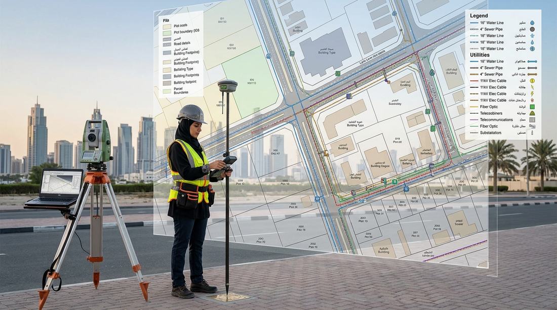
Cadastral surveying is particularly important for land administration.
A cadastral survey establishes information relating to:
- Land boundaries
- Coordinates
- Plot dimensions
- Areas
- Boundary markers
- Property-related spatial information
In Dubai, the official legal framework defines a cadastral map as a map showing the boundaries, coordinates, area, dimensions and use of a privately owned land plot based on Land Department records and the emirate's master plan.
Cadastral information therefore provides the spatial foundation for many property and development processes.
It is also important to understand the difference between a survey plan and a broader GIS database. A survey plan represents a specific survey purpose, while a GIS database can integrate thousands or millions of spatial features and their associated attributes.
6. Topographic and Engineering Surveys
Topographic surveying remains fundamental to construction and infrastructure projects.
A modern topographic survey may capture existing ground levels, roads, buildings, kerbs, walls, fences, drainage structures, utility features, street furniture, manholes, poles, signs, terrain information and other natural and man-made features.
The collected information can then be processed into CAD drawings, GIS datasets, digital terrain models and engineering deliverables. For large infrastructure projects, the survey is often only the beginning — the resulting information must then be integrated with engineering design, GIS databases and project-management systems.
7. Surveying and GIS: Two Connected Worlds
One of the most important developments in the UAE is the increasing integration of surveying and GIS.
Surveying provides highly accurate field measurements. GIS provides a framework for managing, analyzing and displaying spatial information.
For example, a survey team may collect the coordinates of a newly constructed road. The GIS team can then integrate that information with existing road networks, property boundaries, buildings, water networks, sewerage networks, electricity networks, telecommunications, irrigation, stormwater and transportation assets.
The result is much more valuable than a standalone CAD drawing. Instead of simply asking "Where is this feature?", a GIS can answer "Where is this feature, what is it connected to, who owns it, what attributes does it have, and how does it relate to surrounding infrastructure?"

8. Digital Survey Submission and Quality Control
The modern UAE survey workflow is increasingly digital. Surveying companies and licensed surveyors are expected to follow the relevant authority's procedures and technical requirements.
Abu Dhabi City Municipality, for example, has conducted training workshops for surveying companies and licensed surveyors covering registration, licensing, procedures, technical requirements and the submission of survey data. The municipality specifically emphasized adherence to applicable guidelines and regulations to improve the quality and efficiency of submitted data.
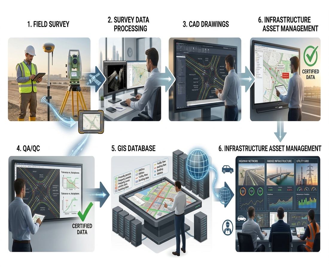
A typical modern workflow can therefore be represented as:
Field Survey → GNSS / Total Station / Level / Mobile Mapping → Survey Processing → CAD / GIS Preparation → Quality Control → Digital Submission → Authority Review → Approval / Comments / Revision → Official Spatial Database
This digital workflow helps reduce inconsistencies between field information, engineering drawings and government spatial databases.
9. The Role of GIS Databases
Government GIS databases are becoming increasingly important for urban management. A modern municipal GIS may contain layers representing:
Land and cadastral information — plot boundaries, land use, administrative boundaries, development areas
Buildings — building footprints, structures, building attributes
Transportation — roads, road centerlines, curbs, parking areas, traffic assets, road signs
Utilities — water, sewerage, electricity, telecommunications, irrigation, stormwater
Survey and control — survey control points, boundary markers, reference stations, survey-related information
The accuracy of these databases depends heavily on the quality of the original survey data.
10. MyLand and Public Geospatial Information in Abu Dhabi
Abu Dhabi has also expanded public access to geospatial information through digital platforms.
DMT's MyLand platform provides a geospatial portal covering Abu Dhabi, Al Ain and Al Dhafra municipalities. The platform includes tools such as plot search and multiple spatial layers relating to development, planning and administrative information.
This demonstrates an important trend: geospatial information is increasingly being delivered through web GIS rather than only through traditional printed maps or CAD drawings. For planners, engineers, surveyors, consultants and the public, web-based GIS can provide a common spatial reference for understanding land and development information.
11. LiDAR, Aerial Photography and Remote Sensing
Surveying in the UAE is also expanding beyond ground-based measurements. Large-scale projects may use UAV/drone surveys, aerial photography, LiDAR, satellite imagery, mobile mapping, photogrammetry and 3D point clouds.
These technologies can collect enormous quantities of spatial information over large areas. LiDAR, for example, can generate dense point clouds that can be used to model terrain, buildings, roads, vegetation, infrastructure and other physical features.
Abu Dhabi's cadastral station system is already used in connection with aerial photography, LiDAR and other surveying projects.
12. The Rise of 3D Surveying and Digital Twins
The next stage of surveying is moving toward three-dimensional geospatial environments. Instead of maintaining only 2D maps, authorities can combine Survey + GIS + BIM + 3D City Models + Real-Time Data.
Abu Dhabi's DMT announced in 2026 the development of Nabd, a digital platform designed to bring together data from DMT systems, sensors and infrastructure into a single digital model of the emirate.
According to DMT, Nabd is designed to provide a live three-dimensional view incorporating buildings, roads, utilities, underground infrastructure and other urban assets. The announced first phase is expected to go live in early 2027.
This direction is significant because the future of surveying is not simply about producing a drawing. It is increasingly about creating an accurate digital representation of the physical environment.
13. Surveying Standards and Professional Licensing
Technology alone does not guarantee accurate survey information. Professional standards remain essential.
Surveyors and surveying companies must work according to the applicable regulations and requirements of the relevant authority. Dubai's survey legislation, for example, requires authorization for professions associated with survey works and gives Dubai Municipality responsibility for regulating surveying activities and maintaining official survey information. Abu Dhabi also works directly with surveying companies and licensed surveyors to communicate updated procedures and requirements.
Therefore, a professional surveyor in the UAE needs a combination of surveying knowledge, GNSS expertise, coordinate-system knowledge, CAD skills, GIS skills, data-management skills, quality-control procedures, knowledge of authority standards, and understanding of digital submission systems.
14. Why Accurate Survey Data Matters
Surveying is the foundation of many development activities. An error in coordinates can potentially affect plot boundaries, building locations, road alignments, utility routes, infrastructure construction, property information, engineering design and GIS databases.
This is why modern surveying systems place strong emphasis on control networks, standardized coordinate systems, quality assurance and digital validation. A highly accurate survey connected to an authoritative coordinate framework can become a reliable source of information for multiple departments and projects.
15. The Future of Surveying in the UAE
The UAE's surveying sector is moving toward an increasingly integrated geospatial ecosystem. The major trends include:
- GNSS and real-time positioning — reference networks and correction services will continue to support precise field positioning
- Automated quality control — more survey data will be checked automatically for geometry, coordinates, attributes and compliance
- GIS integration — survey information will increasingly flow directly into enterprise GIS databases
- 3D geospatial data — point clouds, 3D buildings and digital terrain models will become more common
- BIM and GIS integration — engineering models and government spatial databases will increasingly interact
- Digital twins — urban authorities are moving toward continuously updated digital representations of cities
- AI and spatial analytics — artificial intelligence can assist with feature extraction, change detection, data validation and urban analysis
- Real-time city data — sensors, IoT devices and infrastructure systems can increasingly contribute information to spatial platforms
Conclusion
The current surveying system in the UAE represents a significant transformation from traditional field surveying toward a connected digital geospatial ecosystem.
GNSS reference networks provide precise positioning. Total stations and digital levels continue to support engineering measurements. CAD and GIS transform survey observations into usable spatial datasets. Government platforms provide controlled digital workflows, while LiDAR, aerial imagery, 3D models and digital-twin technologies are expanding the role of geospatial information.
Abu Dhabi's cadastral station network and Dubai's Virtual Reference Station demonstrate how advanced positioning infrastructure supports surveying and infrastructure development. Meanwhile, platforms such as Abu Dhabi's MyLand and emerging 3D initiatives demonstrate how survey information is increasingly becoming part of wider digital-government systems.
The future UAE surveyor will therefore need to be more than a field measurement specialist. The profession is increasingly becoming a combination of surveying, GNSS, GIS, CAD, data management, automation, 3D modelling and geospatial technology.
For professionals entering or developing their careers in the UAE, understanding this transition is becoming just as important as understanding the surveying instruments themselves.
Khurram Shahzad
← Back to all articles